Urban Lighting
Urban Lighting
An urban lighting data and ML platform for field inventory, mobile laboratory measurements, geospatial mapping, and LightGBM-based reconstruction planning.
The project combined several earlier tools into one pipeline: collect field data, process real illuminance measurements, map the results, train an ML model, and prepare reconstruction recommendations.
Goal
The goal was to make urban lighting reconstruction planning faster and more data-driven: replace manual field reports and fragmented maps with reusable datasets, prediction models, analytics, and planning documents.
Project Evolution
The platform grew from three connected engineering stages. The strongest part was the final ML and analytics layer; the earlier tools created the structured data needed for prediction and reconstruction planning.
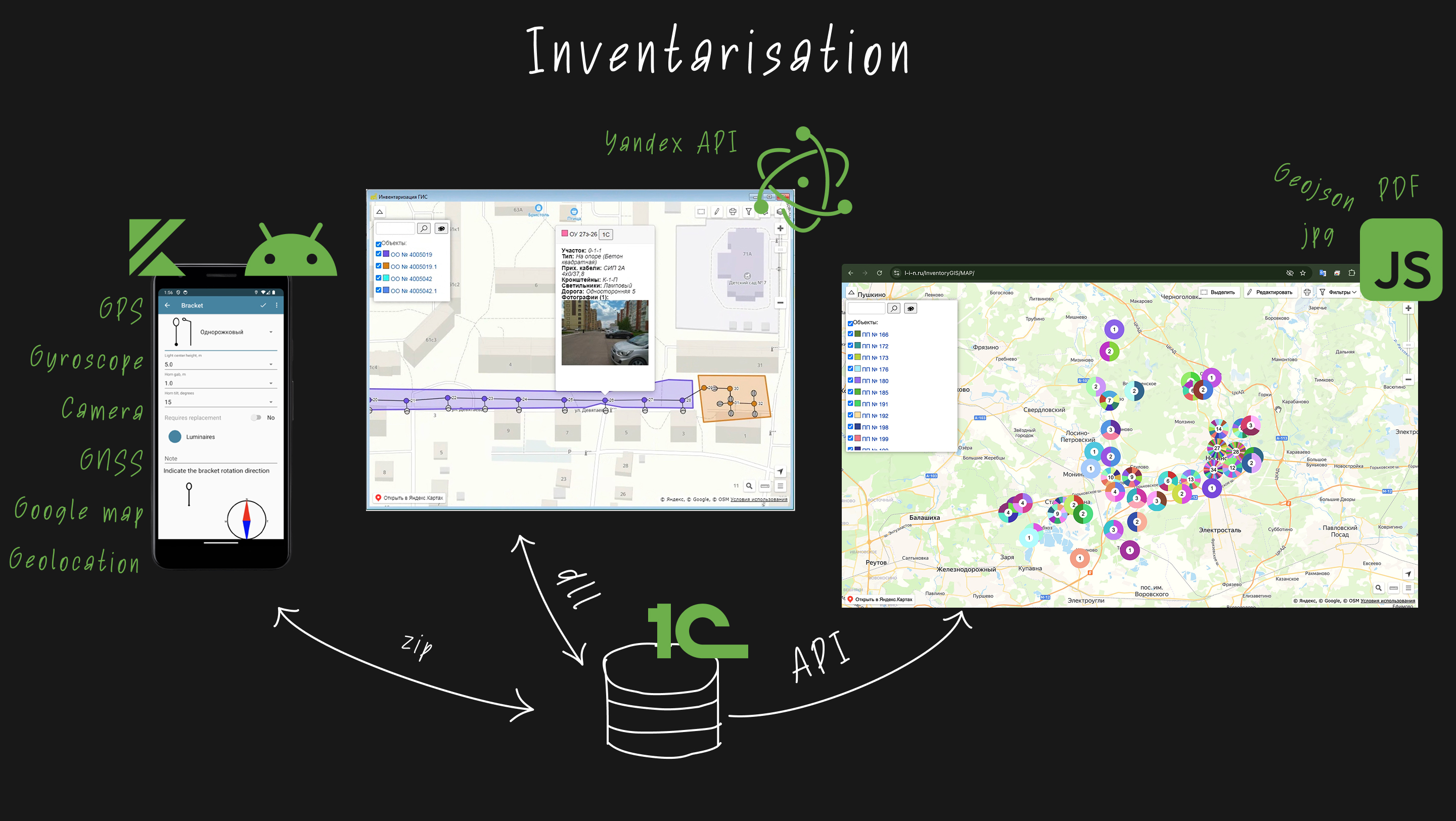
Field inventory layer: Android and desktop tools for collecting poles, luminaires, coordinates, photos, and object metadata during field inspections.
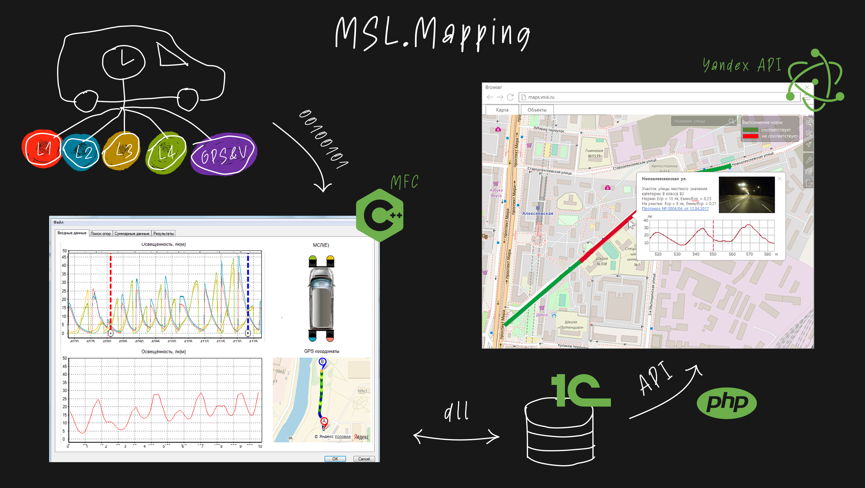
Measurement layer: processing of mobile laboratory data: GPS tracks, sensor measurements, illuminance values, road segments, and map visualization.
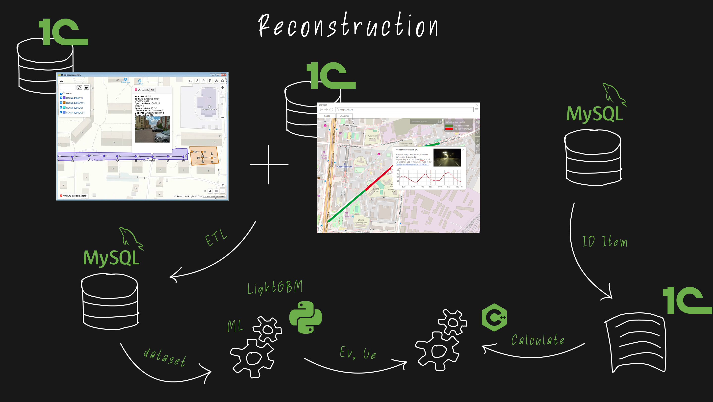
ML reconstruction layer: dataset preparation, LightGBM-based illuminance prediction, detection of non-compliant zones, LED replacement recommendations, economic calculations, and tender materials.
What I Built
- Designed the platform as a pipeline from field data to ML-assisted reconstruction planning.
- Built tools for outdoor lighting asset inventory and map-based data management.
- Developed processing logic for mobile laboratory measurements, GPS tracks, and illuminance data.
- Connected inventory, measurement, and geospatial data into reusable datasets.
- Built the ML dataset and LightGBM model for street illuminance prediction.
- Added analytics for lighting quality, reconstruction options, LED replacement, economic effect, and planning documentation.
Stack
Android, Electron, JavaScript, Node.js, C++, MFC, GPS/sensor data processing, 1C, PostgreSQL/MySQL-style databases, geospatial data, Python, LightGBM, feature engineering, Google Maps API.
My Role
Technical lead and full-stack developer. I designed key parts of the architecture, developed data processing components, built the ML dataset and prediction model, and connected field data, measurements, maps, and analytics into a reconstruction planning workflow.
I coordinated work with software developers, analysts, and field engineering stakeholders to connect practical data collection needs with the ML and planning layer.